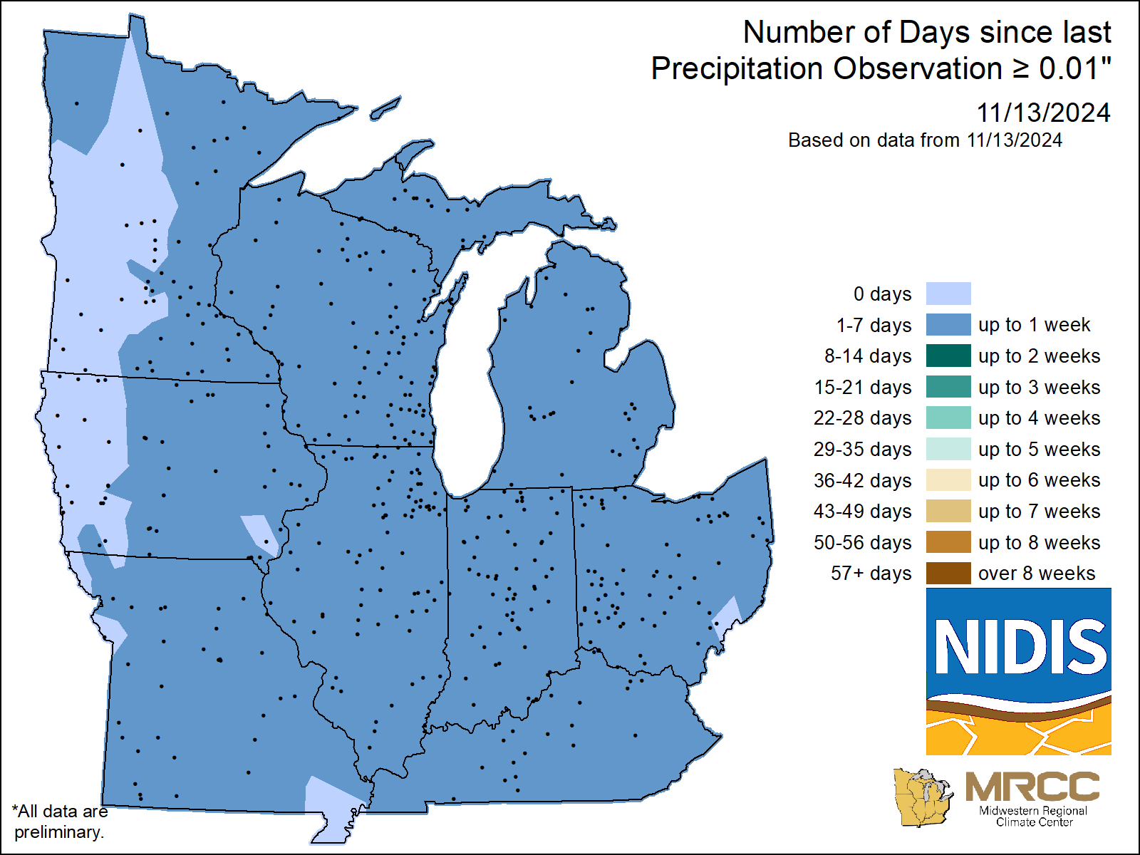
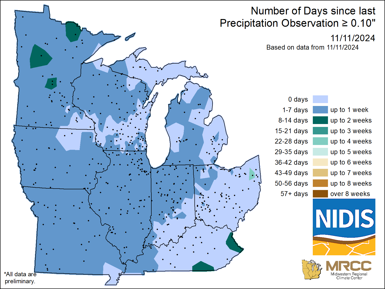
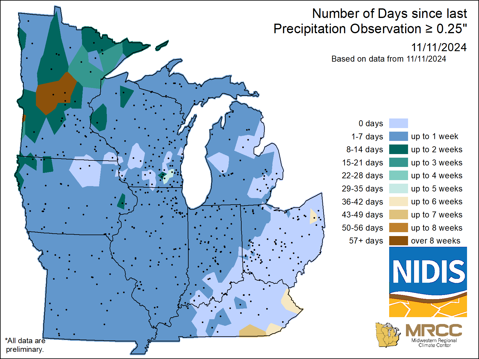
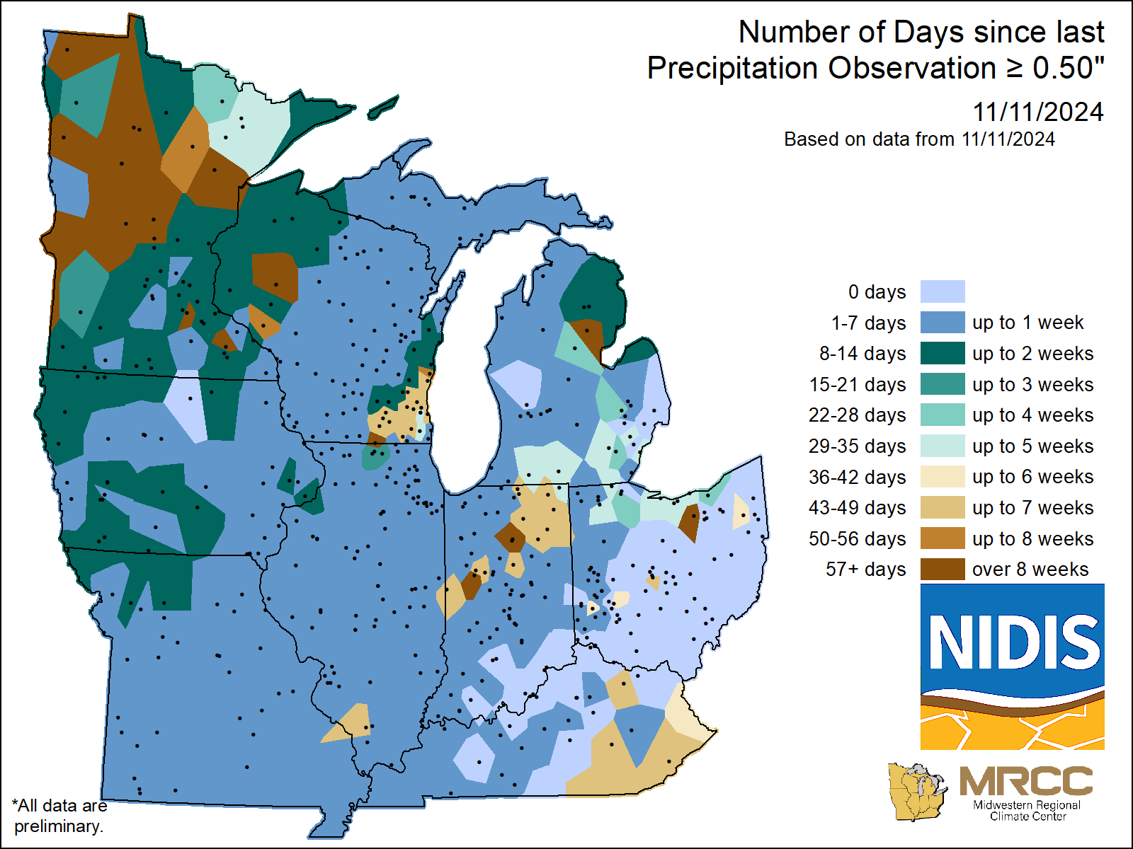
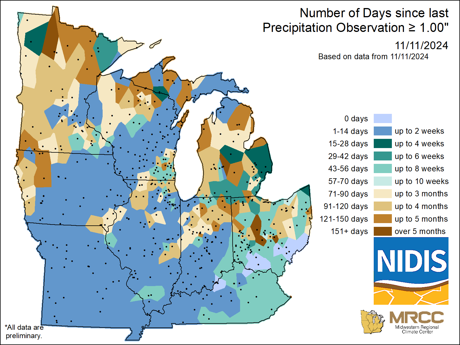
Days without Precipitation Maps
Use these maps to track the number of days without precipitation (DWOP) across the Midwest, based on five daily thresholds: 0.01 inches, 0.10 inches, 0.25 inches, 0.50 inches, and 1.00 inches. Data is compiled from National Weather Service COOP stations, FAA/WBAN, and CoCoRaHS. Since CoCoRaHS data is delayed, maps are archived and updated daily as new data becomes available. Maps show streaks of consecutive days without precipitation, with no missing data allowed. For example, a seven-day streak is excluded if any day in that period has missing data. A new streak starts when precipitation meets or exceeds the threshold or when data reporting resumes. This product covers the past 365 days.
